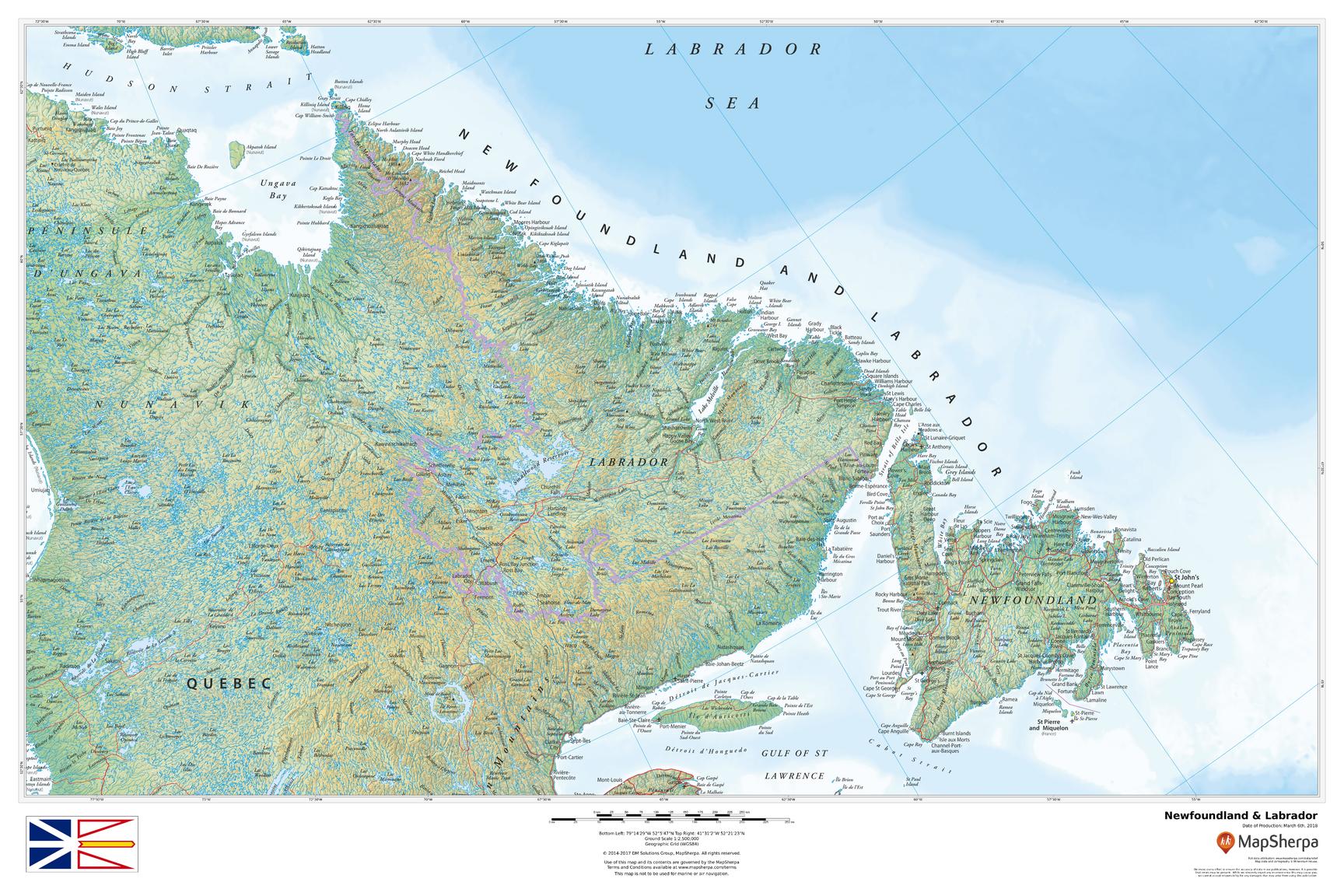
Hamilton Inlet is a fjord-like inlet of Groswater Bay on the Labrador coast of the Canadian province of Newfoundland and Labrador. Together with Lake Melville, it forms its province's largest estuary, extending over 140 km (87 mi) inland to Happy Valley-Goose Bay and primarily draining the Churchill River and Naskaupi River watersheds. Lake Melville is generally considered a part of Hamilton Inlet and extends west of the deep, narrow passage at the community of Rigolet.
| Attributes | Values |
|---|
| rdf:type
| |
| rdfs:label
| - Hamilton Inlet (de)
- Hamilton Inlet (en)
- Hamilton Inlet (es)
- Hamilton Inlet (fr)
- ハミルトン湾 (ja)
- Hamilton Inlet (nl)
|
| rdfs:comment
| - Hamilton Inlet is a fjord-like inlet of Groswater Bay on the Labrador coast of the Canadian province of Newfoundland and Labrador. Together with Lake Melville, it forms its province's largest estuary, extending over 140 km (87 mi) inland to Happy Valley-Goose Bay and primarily draining the Churchill River and Naskaupi River watersheds. Lake Melville is generally considered a part of Hamilton Inlet and extends west of the deep, narrow passage at the community of Rigolet. (en)
- ハミルトン湾(ハミルトン入江、Hamilton Inlet)はカナダ東部・ラブラドール半島の東海岸に食い込んだフィヨルド状の湾。大河チャーチル川およびナスコーピ川(Naskaupi River)が注ぎ込むメルヴィル湖が湾の奥にあってつながっており、ともにこの地方最大の河口を形成している。メルヴィル湖もハミルトンの入江の一部とみなされることもある。 ハミルトン湾の長さは140kmで、最奥部に空軍基地の町(Happy Valley-Goose Bay)がありラブラドール地方の中心となっている。この町はラブラドル海から遠く、霧の発生が少ないことから基地建設が行われて発展した。湾口にはリゴレット(Rigolet)という共同体があり、狭く深い海峡を形成している。 湾岸のカートライト(Cartwright)やルイスポート(Lewisporte)からハッピーバレー・グースベイへはフェリーが通っている。 (ja)
- Hamilton Inlet is een estuarium in het oosten van de Canadese regio Labrador. Het zoutwater bevattend estuarium is fjordachtig en maakt de verbinding tussen het grote, westelijk gelegen estuarium Lake Melville en de oostelijk gelegen . Rigolet is de enige aan Hamilton Inlet gelegen plaats. (nl)
- Hamilton Inlet ist der Name einer fjord- oder fjärdartigen Bucht an der Küste Labradors in der kanadischen Provinz Neufundland und Labrador. Den äußeren Teil bildet die . Gemeinsam mit dem Lake Melville, einer Inlandsbucht, bildet das Hamilton Inlet den größten Meeresarm der Provinz. Dieser erstreckt sich über 140 Kilometer landeinwärts bis zur Stadt Happy Valley-Goose Bay. Die Bucht wird von den Flusssystemen des Churchill River und des Naskaupi River gespeist. Sie wurde nach dem Gouverneur von Neufundland Sir Charles Hamilton benannt. (de)
- El Hamilton Inlet es un fiordo o entrante en la costa de la península del Labrador, en el fondo de la bahía Groswater, en la provincia canadiense de Terranova y Labrador. Junto con el lago Melville forma el estuario más grande de la provincia, que se extiende más de 140 kilómetros hacia el interior por la bahía Goose-valle Happy, y sobre todo, drena las cuencas del río Churchill y del . El lago Melville se considera una parte de Hamilton Inlet y se extiende profundamente en dirección oeste, por el estrecho paso cerca de la comunidad de Rigolet. (es)
- Hamilton Inlet est un estuaire sur la côte du Labrador, dans la province canadienne de Terre-Neuve-et-Labrador. Avec le lac Melville, il forme le plus vaste estuaire de la province, qui s'étend sur 250 km entre Happy Valley-Goose Bay et la mer du Labrador. Quatre grands cours d'eau, dont le fleuve Churchill et les rivières Naskaupi, Kenamu et Goose, alimentent Hamilton Inlet. (fr)
|
| foaf:name
| |
| name
| |
| geo:lat
| |
| geo:long
| |
| foaf:depiction
| |
| location
| |
| dcterms:subject
| |
| Wikipage page ID
| |
| Wikipage revision ID
| |
| Link from a Wikipage to another Wikipage
| |
| Link from a Wikipage to an external page
| |
| sameAs
| |
| dbp:wikiPageUsesTemplate
| |
| thumbnail
| |
| caption
| - A map of the Lake Melville/Hamilton Inlet/Groswater Bay system, showing Hamilton Inlet as inclusive of L. Melville (en)
|
| countries
| |
| location
| - south central Labrador, between Lake Melville and Groswater Bay (en)
|
| pushpin map
| - Canada Newfoundland and Labrador (en)
|
| pushpin map caption
| - Location in Labrador (en)
|

![http://dbpedia.org/describe/?url=http%3A%2F%2Fdbpedia.org%2Fresource%2FHamilton_Inlet]()


![[RDF Data]](/fct/images/sw-rdf-blue.png)


![[RDF Data]](/fct/images/sw-rdf-blue.png)


![[cxml]](/fct/images/cxml_doc.png)
![[csv]](/fct/images/csv_doc.png)
![[text]](/fct/images/ntriples_doc.png)
![[turtle]](/fct/images/n3turtle_doc.png)
![[ld+json]](/fct/images/jsonld_doc.png)
![[rdf+json]](/fct/images/json_doc.png)
![[rdf+xml]](/fct/images/xml_doc.png)
![[atom+xml]](/fct/images/atom_doc.png)
![[html]](/fct/images/html_doc.png)